
Auburn Ravine History:
The Creek That Helped Give Birth to Auburn
Long before there was an Old Town Auburn, a courthouse, or even a community called Auburn, water was carving its way through the foothills. The Auburn Ravine may appear modest today, but this winding creek played an extraordinary role in shaping the town we know and love.
Before the Gold Rush
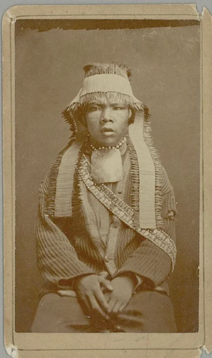
The history of Auburn Ravine did not begin with the discovery of gold. The Auburn area lies within the ancestral homelands of the Nisenan people, who lived throughout this region for thousands of years before European-American settlement. Creeks, oak woodlands, wildlife, native plants, and seasonal food sources were all part of an interconnected landscape that sustained local villages and cultural traditions.
That earlier history is important because the familiar version of Auburn’s story often begins in 1848. In reality, the Gold Rush did not create an empty landscape. It dramatically transformed a place that already held generations of human history.
The Discovery That Changed Auburn Forever
According to the City of Auburn’s historical account, French miner Claude Chana discovered gold along Auburn Ravine in May 1848, approximately one-quarter mile south of what is now Old Town. Chana was traveling toward the gold fields near Coloma when the glimmer of gold in the ravine persuaded him and others to remain and prospect the area.
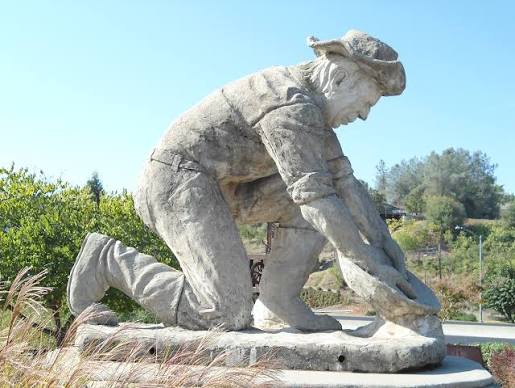
News traveled quickly. Miners began arriving, temporary camps appeared, and additional discoveries were made in the surrounding ravines and at Rich Flat, near present-day Railhead Park. What began as a scattering of mining claims rapidly developed into a busy settlement.
The growing camp was known by several names, including North Fork Dry Diggings, Rich Ravine, and Woods Dry Diggings. In August 1849, the community was officially named Auburn, reportedly by miners familiar with Auburn, New York.
Mining the Ravine
Auburn Ravine became both a workplace and a pathway to possibility. Early miners used pans, rockers, sluice boxes, and “Long Toms” to separate gold from gravel and sediment. Water was essential to the process, making the ravine itself one of the town’s most valuable natural resources.
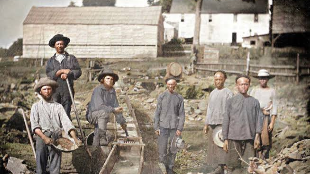
An extraordinary photograph taken in 1852 shows white and Chinese miners gathered beside a sluice box at the head of Auburn Ravine. The image is more than a picture of mining equipment. It is evidence that Auburn’s early population was more diverse and its social history more complicated than many simplified Gold Rush stories suggest.
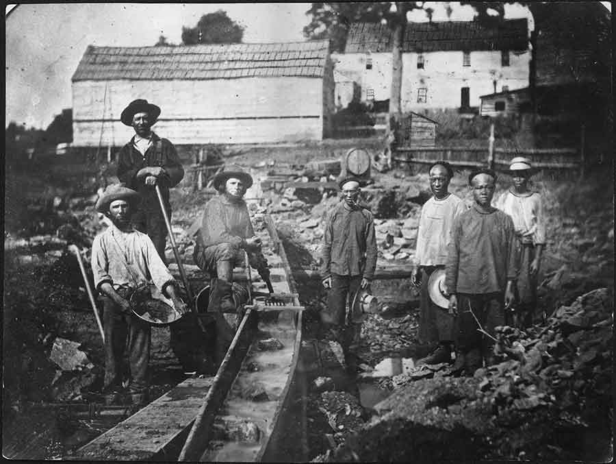
Chinese miners were an important part of California’s mining economy, frequently reworking claims that others had abandoned. Yet they also endured discriminatory taxes, exclusion, violence, and restrictions on where they could live and work. Remembering their presence gives us a more complete—and more honest—understanding of the people who helped shape the Auburn Ravine region.
From Mining Water to Agricultural Water
As the easiest gold became harder to find, Auburn’s economy began to change. The network of ditches and canals originally developed to move water for mining increasingly supported farms, orchards, ranches, and growing communities. Auburn Ravine became part of a much larger water-delivery system that helped transform western Placer County into productive agricultural land.
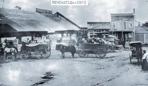
The creek travels nearly 34 miles from Auburn through Ophir, Newcastle, and Lincoln before continuing across the valley toward the Sacramento River near Verona. Water has been imported into the ravine for more than 150 years, which means some of the summertime flow visible today comes through an engineered system of reservoirs, canals, pipes, and diversions.
The Salmon’s Long Journey Home
Auburn Ravine is not only a historical waterway; it is also living habitat. Chinook salmon, steelhead, Pacific lamprey, and other native species have depended on the watershed, but dams and water diversions created barriers that prevented fish from reaching portions of their historic spawning grounds.
One of the most significant barriers was the eight-foot Hemphill Diversion Dam near Lincoln. Built during the early 1900s to direct water into an irrigation canal, the dam blocked most migrating fish from traveling farther upstream for approximately a century.
In 2022, the concrete dam was removed and replaced with a gently sloped, roughened rock ramp. The new structure continues to deliver irrigation water while allowing fish to swim upstream. The project reopened nearly six miles of spawning and rearing habitat—a remarkable meeting point between the ravine’s agricultural history and its ecological future.
For more information and how to help this incredible restoration, visit https://sarsas.org/
In late 2025, survey teams documented salmon as far upstream as the Gold Hill Road area near Newcastle. For a creek so closely associated with Auburn’s beginnings, the return of salmon feels especially meaningful: the ravine is once again revealing another chapter of its story.
A Quiet Landmark Hiding in Plain Sight
Auburn Ravine does not announce itself like the courthouse dome or the historic storefronts of Old Town. It slips beneath roads, curves behind neighborhoods, passes through orchards and ranchland, and continues west toward the valley. Yet without it, Auburn’s history might have unfolded very differently.
The ravine attracted miners, supplied water, supported agriculture, influenced settlement, and now offers renewed hope for native fish. It is a reminder that local history is not found only inside museums or preserved buildings. Sometimes it is still flowing quietly through the landscape.
Looking at Auburn With New Eyes
The next time you cross Auburn Ravine Road or catch sight of the creek, pause for a moment. Imagine the Nisenan families who knew this landscape long before the Gold Rush, the miners working their sluice boxes, the orchardists depending on irrigation water, and the salmon once again pushing upstream.
Auburn Ravine is more than the place where gold was discovered. It is one of the threads connecting Auburn’s earliest human history, its rapid Gold Rush transformation, its agricultural heritage, and its continuing effort to care for the natural world.
Sources and Further Reading
Historical information was drawn from the City of Auburn’s history collection, Placer County historical and environmental records, the California Digital Library, NOAA Fisheries, the City of Lincoln, and Placer County’s Auburn Ravine salmon-restoration report.